Jack Reports · 2022
a unidirectional navigator for the truck driver community
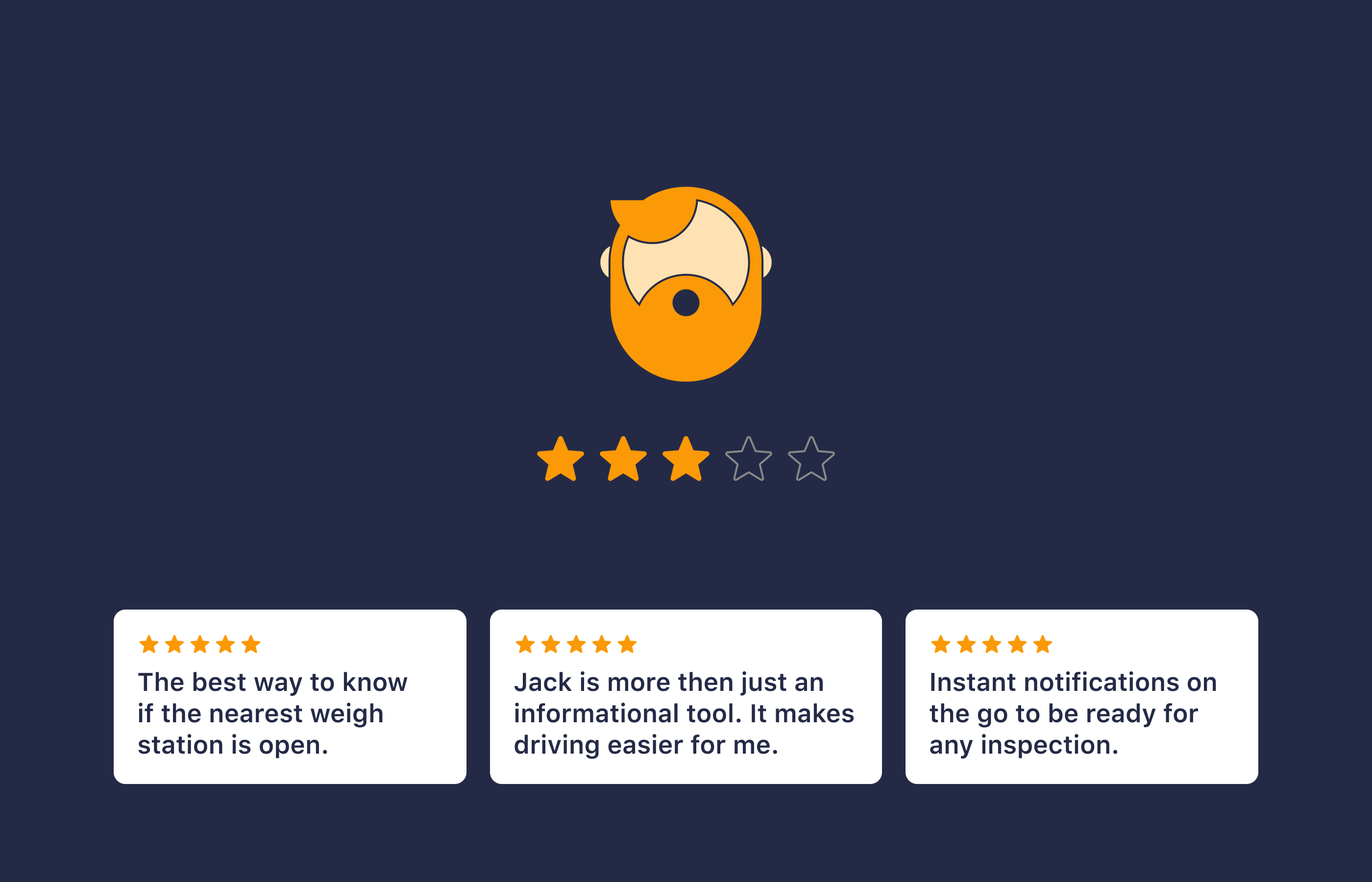
Jack Reports is a mobile navigation app used by professional truck drivers across the United States. It provides detailed, real-time information about weigh stations, road conditions, and other compliance-related data to help drivers stay informed and avoid unnecessary delays.
Problem and challenge
We initially launched the app as an AI-driven, community-supported database of truck-specific places. Drivers used it for trip planning but switched to conventional navigation apps while driving. This led to frequent distractions when checking place status updates.
From a business perspective, this limited the time drivers spent in the app, reducing engagement and community contributions.
So, the design challenge was to keep drivers in the app. Due to our limited resources, we could not compete with full-scale navigation like Google Maps or Waze. That’s why we looked at alternative approaches and navigation devices that prioritised clarity over accuracy.
References and idea
The core idea comes from the concept of transforming two-dimensional map into a simplified, linear path. One of the historical examples of this approach is the itinerary or strip maps that were widely used across Western Europe in the 18th and 19th centuries.
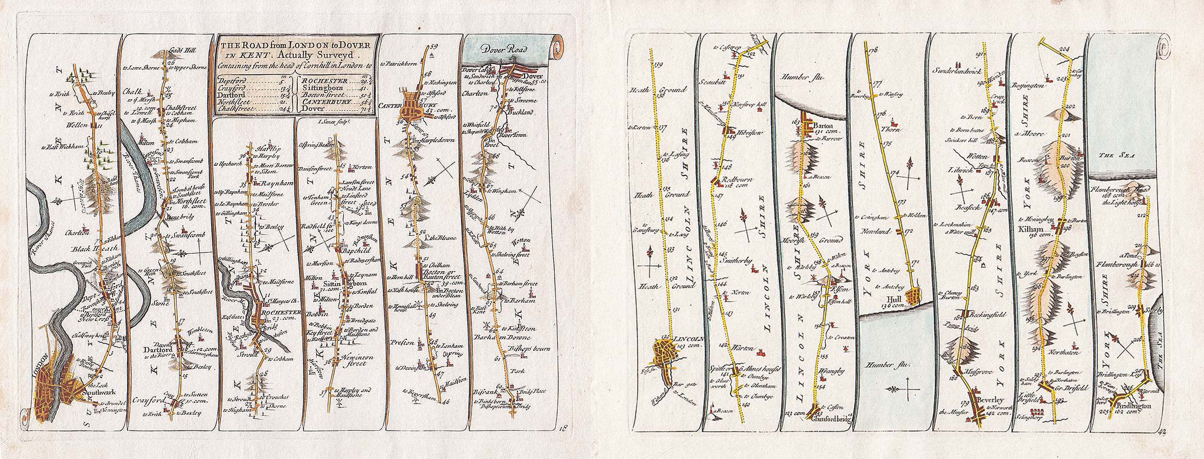
Plan of the road from London to Dover in Kent and from London to Flamborough Head, Plate 18 and 42 from Senex’s “Actual Survey of all the Principal Roads of England and Wales”, published in 1719.
“Such strip maps, something of a wrong-way departure from flatland toward lineland, do allow viewers to edit and to focus directly on the relevant—compensating somewhat for loss of context.”
Edward Tufte, Envisioning Information
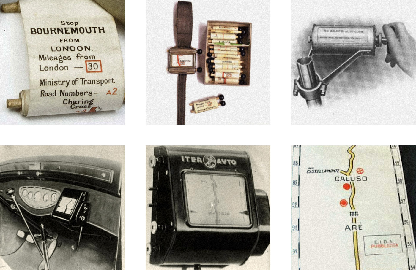
Examples of early automobile navigation devices: Plus Fours Routfinder wrist map, Baldwin Auto Guide, and Iter-Avto.
Another source of inspiration came from early 20th-century automobile navigation devices. These analog scroll-based systems guided drivers using pre-printed, linear routes—essentially paper maps on a roll.
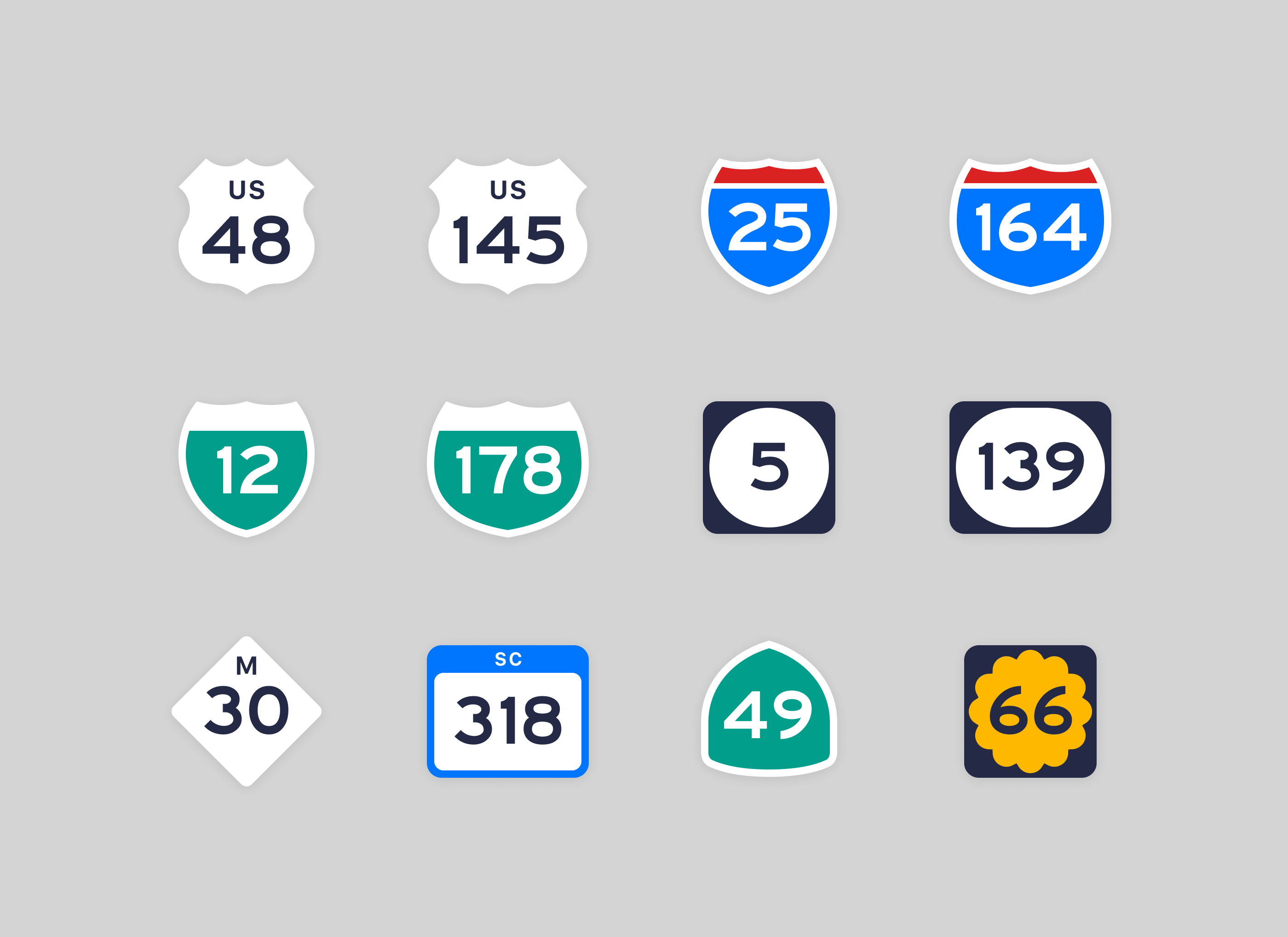
The app’s redesign was also inspired by the brutal yet fascinating layouts and iconic typography of American road signs.
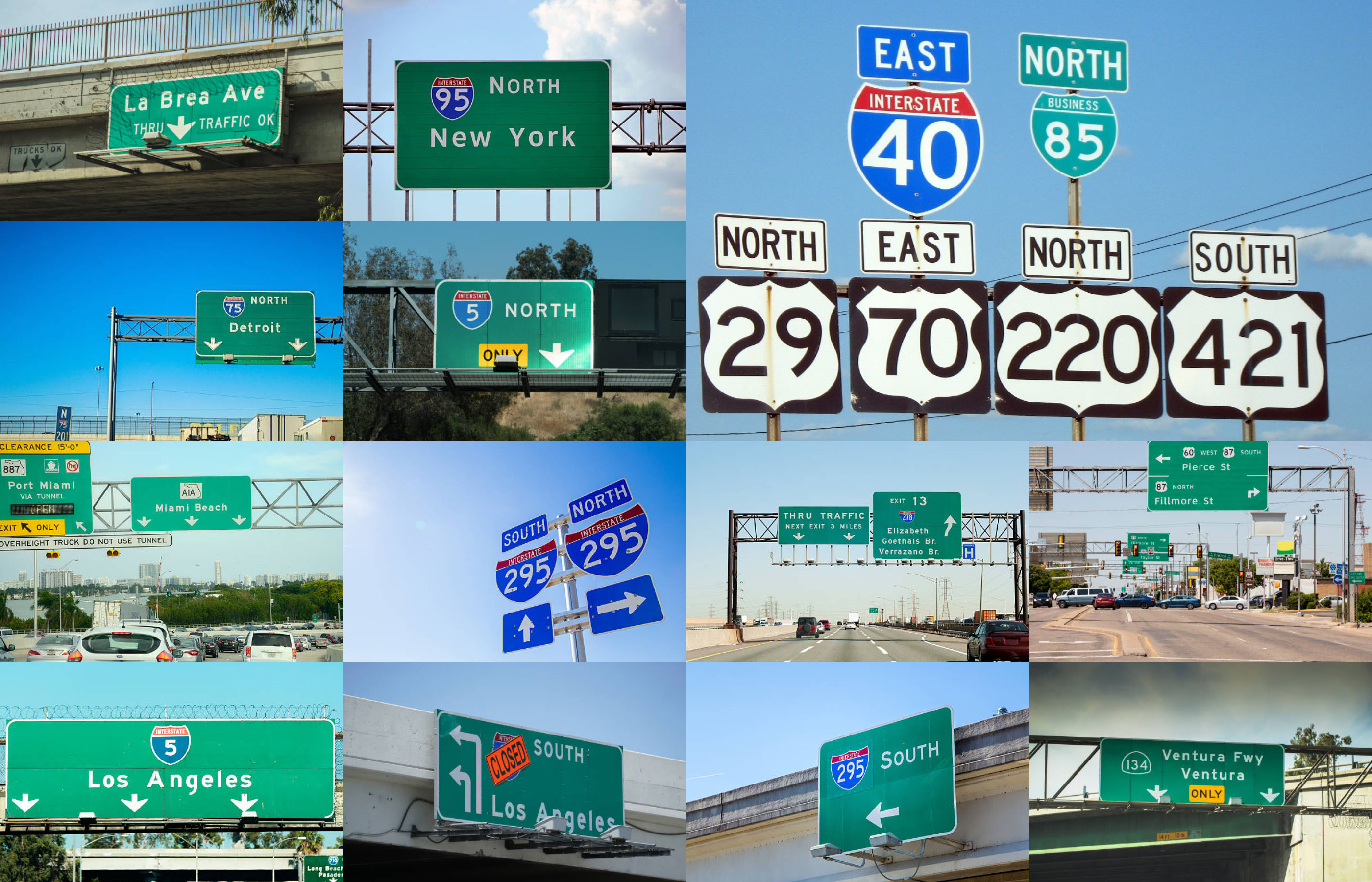
US road sign collection featuring Highway Gothic typeface.
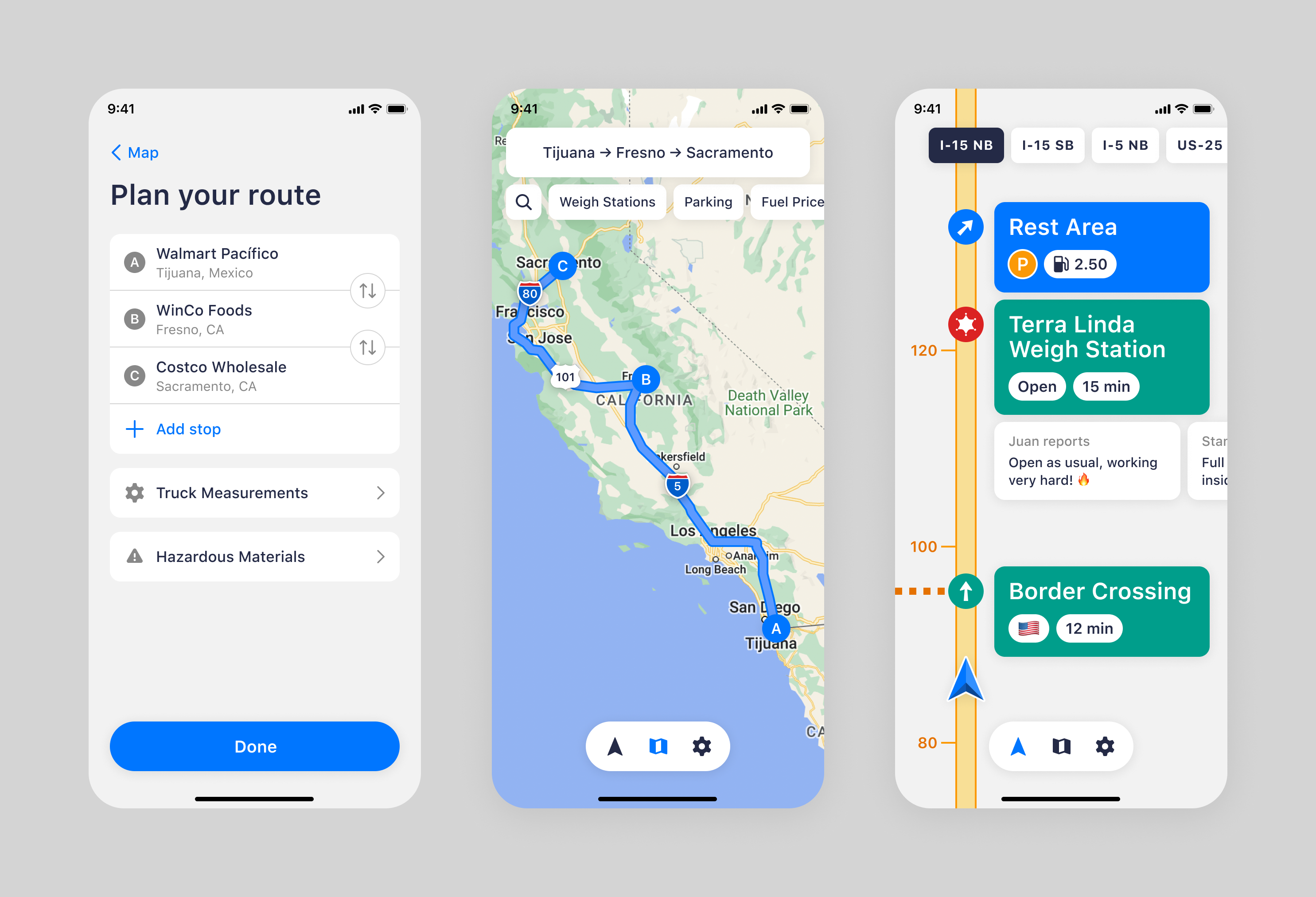
Solution
Through user interviews, we explored the needs, preferences, and unique constraints truckers face. They can’t park or turn wherever they want, and their primary focus is getting to their destination with minimal distraction. The funny thing is that, unlike regular car drivers, truckers usually don’t care what’s happening to the left of the road, because they can’t get there fast enough anyway.
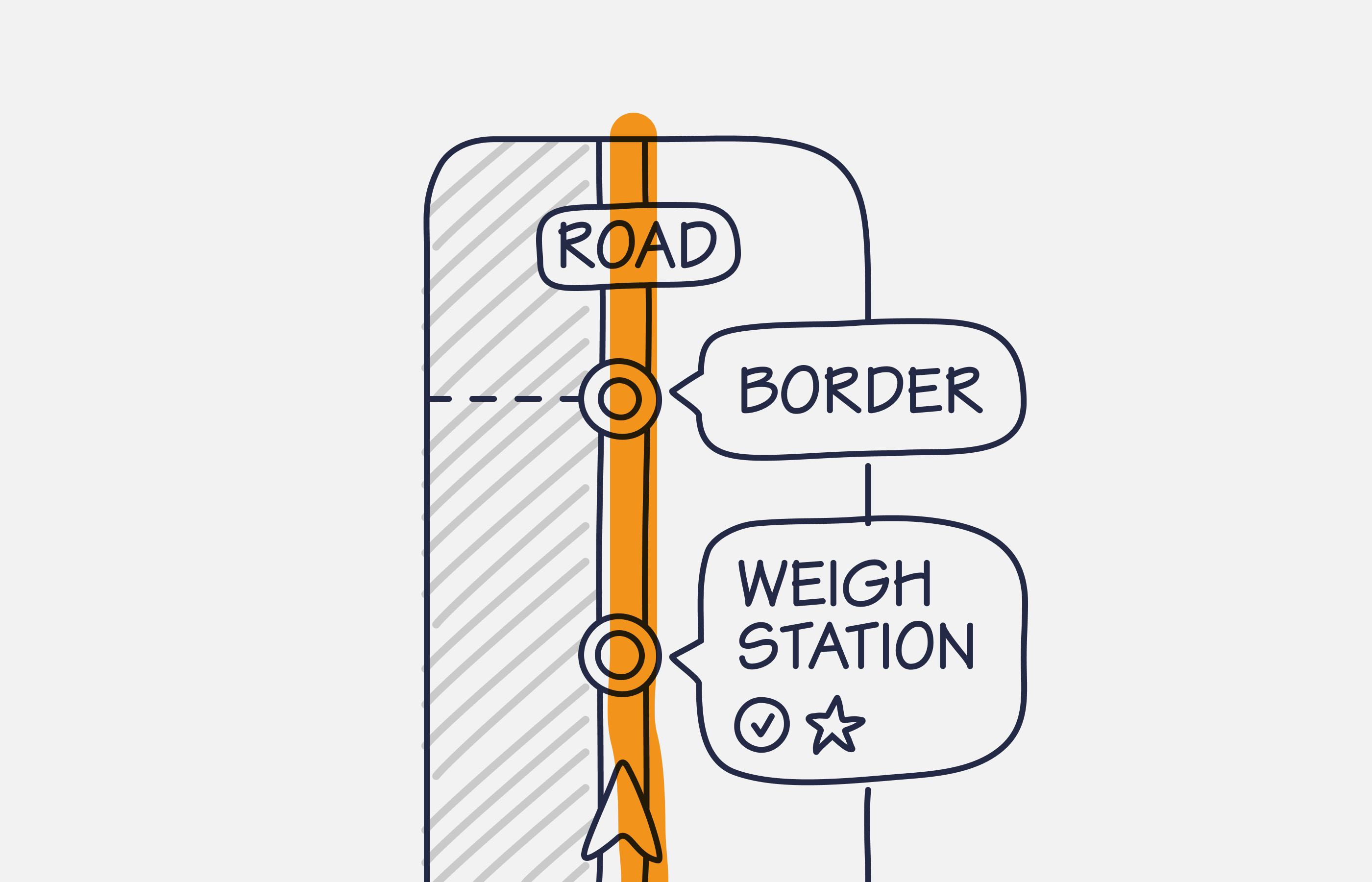
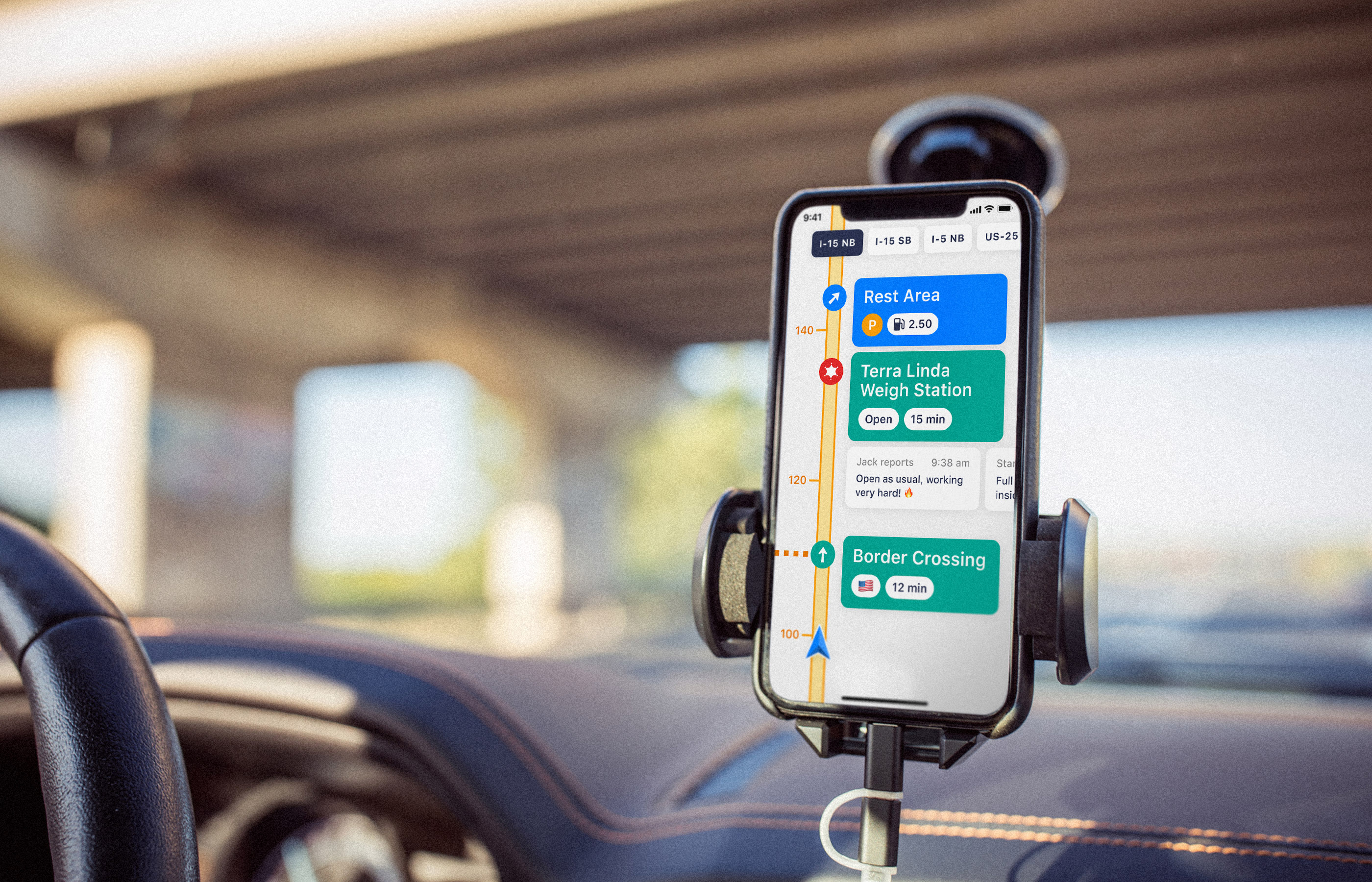
Highway is a new mode in Jack Reports that helps truckers focus on what matters most:
- 🚚 The shortest route to the destination
- 🚔 Police inspections ahead
- 📦 Weigh station schedules and cargo requirements
- ⛔️ State borders with estimated waiting times
- 🚧 Road accidents, dangerous zones, and bridge clearances
- ➡️ Highway exits and rest areas available on the right
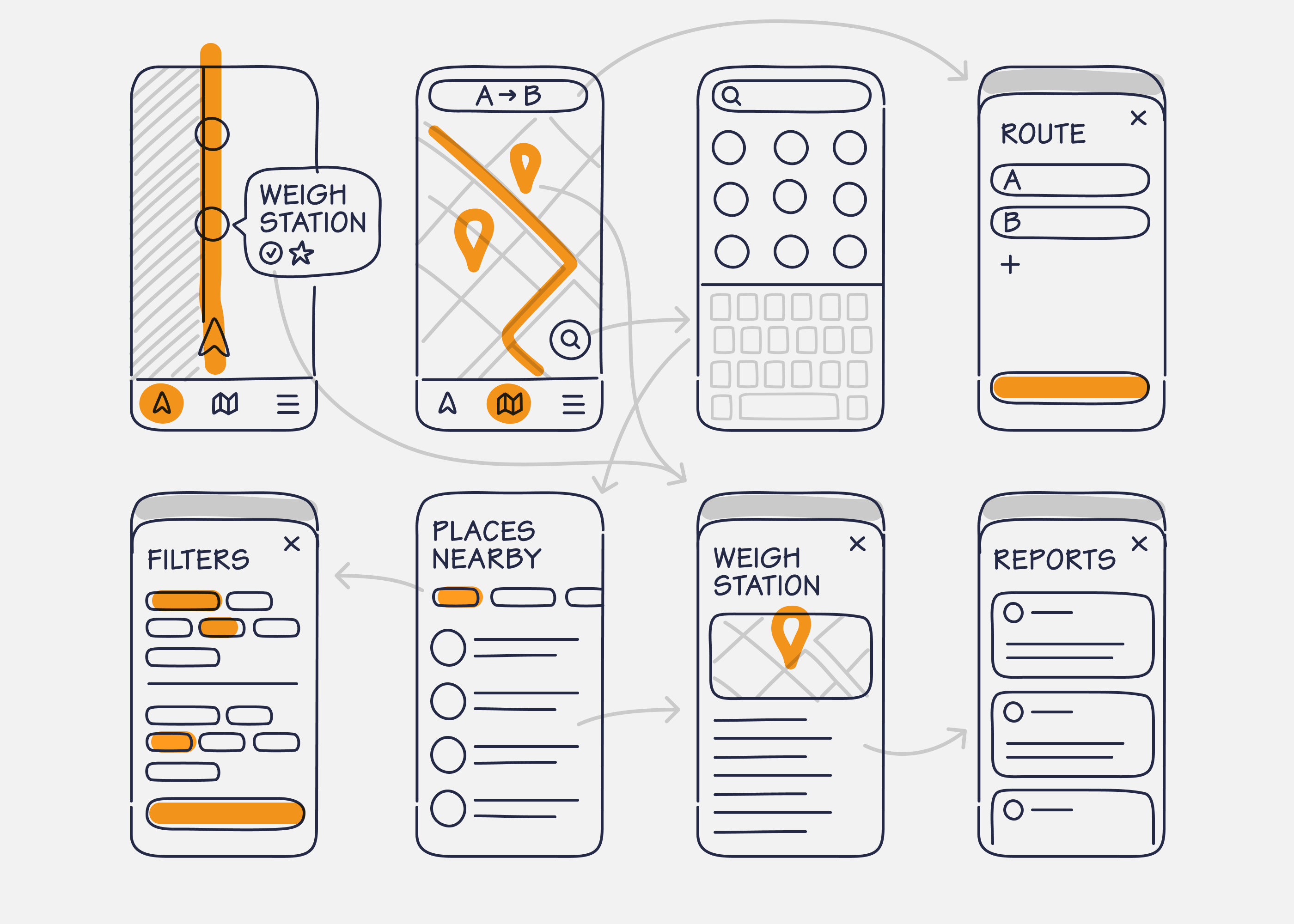
Jack Reports wireframes and navigation between screens.
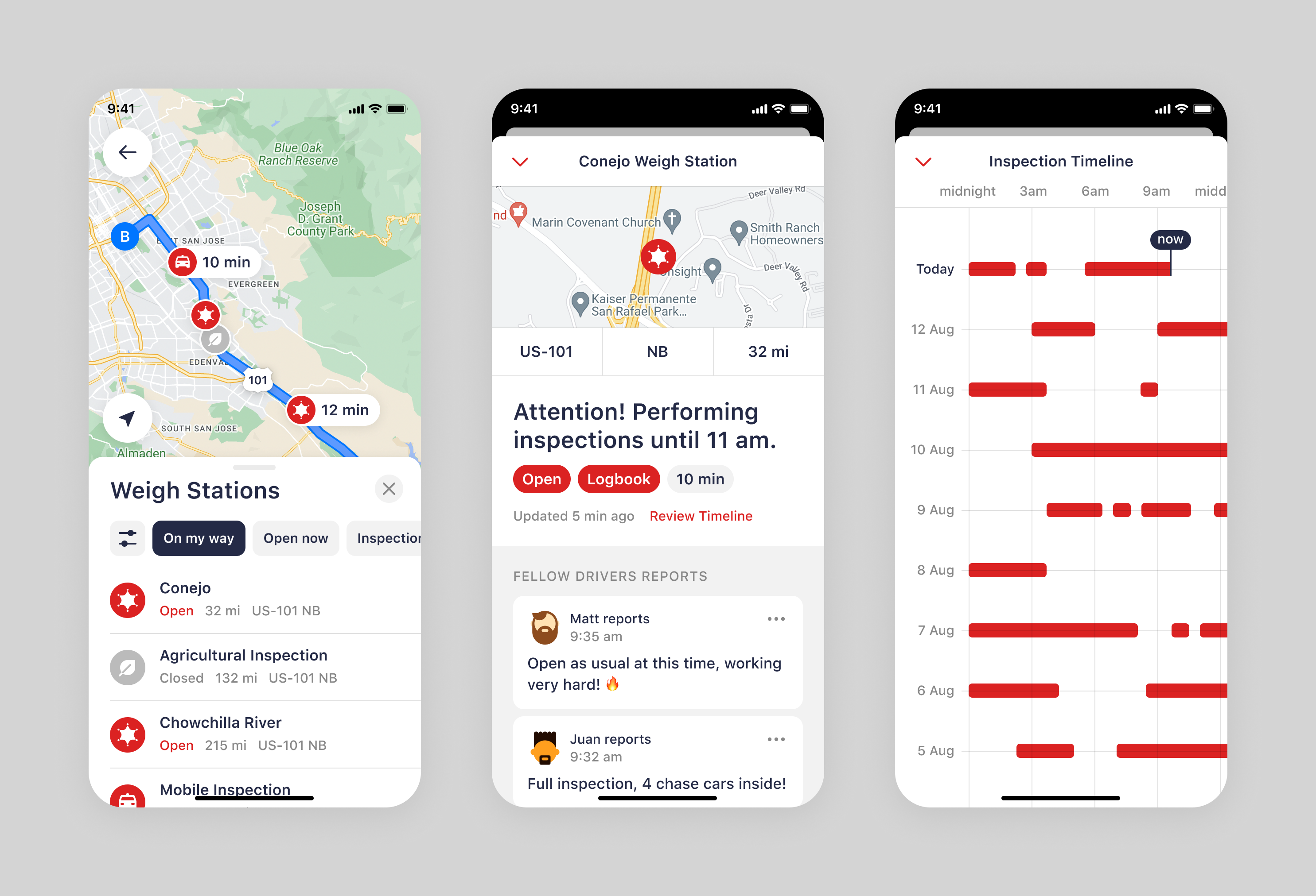
Hi-fidelity prototype
The app offers two modes:
- Conventional map view, a detailed look at the entire route and nearby places.
- Highway mode, to focus on the most important places along the route.

Business impact
The Highway significantly transformed how truck drivers use Jack Reports:
- Session duration increased by 75%, with drivers spending an average of 28 minutes per session.
- User retention grew by 37%, as the app became an essential tool for daily navigation.
- Community contributions doubled, with a 120% increase in real-time updates shared by drivers.
- NPS improved by 15 points, highlighting the enhanced user experience.
- Subscription rates rose by 28%, driven by the added value of the Highway mode.